To take a walk from the car park west, you have to find it
first! It nestles just off the A24 Worthing - London road and can be reached
from Worthing by driving north on the A24 until you reach the Washington
roundabout; take the exit at 4 o’clock, pass the garage on your right and then
turn right almost immediately into Washington village. Drive straight past the
pub on your right and then follow the road up through a wooded area until you
get to a sharp bend left off the tarmac onto a gravelly track that takes you
into the car park.
If you’re heading west on the SDW ,
retrace your route from the car park and cross the A24, then pick up Glaseby
Lane that winds up from the main road. Soon it bends round to the left, past
one or two houses, whilst on the left is the Washington Tap, yes, another water
stop, marked by a sign saying 7 miles to Botolphs, 6 miles to Amberley.
Going on, to the left of the entrance to Bostal Hill Farm
the lane is sealed off to further motor vehicle progress by a lockable metal
pole in the middle of the thoroughfare and a corresponding sign; beyond, the
lane continues steep and sheltered almost completely from the sun, taking you
up to a gate and crossroads. Carry straight on over what appears to be some
sort of cattle trap by the gate. The path continues upwards onto open downland
with views of the Sussex
weald to the north and sheep grazing to the south. It’s a glorious day and you
can see the North Downs in the far distance; betwixt
here and there is gently undulating scenery splashed with plentiful woodland.
As you near the top of the hill just to your right is a concrete
bunker which must have been some sort of world war 2 gun emplacement / lookout
point, complete with hole in the top and slits to peruse the surrounding
country. Much of it is covered in rusting squares of metal.
Shortly, the seascapes have opened up and you can see the English
Channel beyond Worthing and Cissbury ring.
Fields of yet to flower poppies are on both sides. Down to the left is a large
wooded area but before that another concrete bunker snug in the fields.
At this point a route strikes off the path north
(alternative SDW route avoiding the A24).
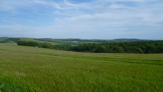 |
| Looking towards Worthing and the sea |
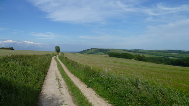 |
| East to Chanctonbury Hill along South Downs Way |
You are now riding the crest of the South Downs
and can see Storrington to the north and the definition of the Isle
of Wight clearly to the west. Open downland dominates the
landscape just as it does east from here to Eastbourne .
At this point we have Sullington Hill to the right and a
path weaves its way down off the main track to Sullington and Storrington. Your
landmark is a large corrugated iron shed. Walking is easy as we’re on the
level.
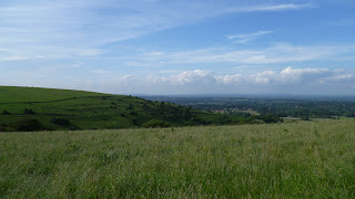 |
| North to Storrington |
You now lose sight of Storrington and are faced with a wonderful sweep of countryside between theSouth Downs
Way and the sea of which you have an uninterrupted
view virtually from Cissbury to the Isle of Wight . The
area immediately to the left is the Angmering Park Estate and forms the
mellowest of English landscapes. It really is a belter of a walk along this
stretch, with landscapes and seascapes a real eyeful for the rambler. Along the
way you hit the Chantry car park, at the top of Chantry Hill, where the signpost marks a major crossroads:
east to Washington , west to
Amberley, north to Storrington, south east to Long Furlong and south to Lee
Farm. A narrow access road falls north from this point to meet the A283 at
Storrington. For the agriculturally minded, grain dominates the landscape.
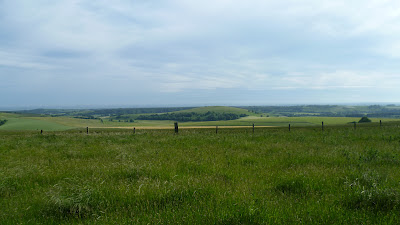 |
| South to the sea |
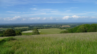 |
| Weald of Sussex |
You now lose sight of Storrington and are faced with a wonderful sweep of countryside between the
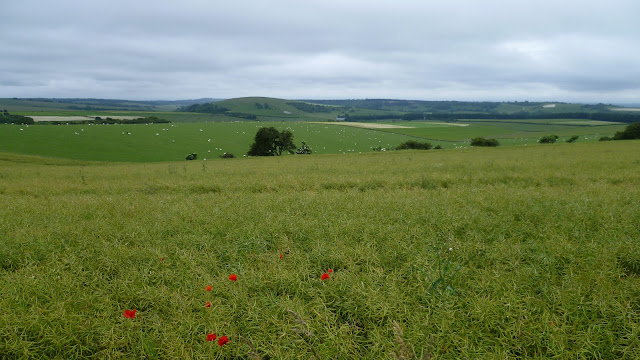 |
| South to the sea |
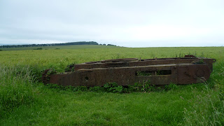
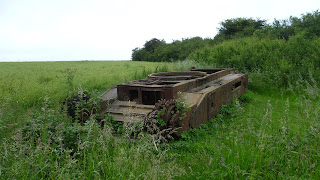
Further on, within sight of Kithurst Hill car park, you reach a sign-posted route down to Storrington to the right (1 and a half miles) and a public bridleway to the left. Strike south on this track and soon you stumble upon the rusting remains of an old battle tank, now a permanent relic.
Back on the SDW , a gentle
descent takes you to the car park, again accessible from the B2139 west of
Storrington – there is space a plenty for cars and it’s an ideal spot for an
evening barbecue. On a hot August day there still the bewitching sight of the Isle
of Wight hazy on the far horizon.
West from Kithurst Hill the path climbs Springhead Hill,
rolling open downland continues to the north and south, with extensive,
unencumbered views of the sea and weald.
You then hit a strip of woodland with a spur that rudely interrupts the
landscape by striking south in a dead straight line of trees, obscuring the
panorama.
Once through the trees, however, you get your first glimpse
of Arundel Castle Downs . At this
point pheasants, possibly the daftest animals on God’s earth, are chasing along
the other side of the fence, and we begin to descend into the Arun valley.
The view opens right out again in three - dimensional
splendour and you can see across to Bignor Hill and Arundel
Park
Soon the path drops steeply with a magnificent vista of the
Arun valley; reaching the level again, with the ample outbuildings of Downs
Farm to the left. The path falls further, winds into some trees, then hits the
road up to Downs Farm from Amberley. You then follow the road down past an
interesting looking Victorian House on the right, set in a nook with an
incomparable setting. It was at this point that in the evening, whilst
retracing my steps, a multi-coloured balloon passed overhead and appeared to
come into land just north of the South Downs . I watched
as it failed to land and skated north across the countryside, eventually
disappearing into the distance as I focused on other things.
You carry straight down to the main Amberley road; on the
way is an interesting little sunken enclosure adjacent to the lane and on the
left – a square of grass, a small shelter and a bench on a mound looking out
over Amberley Museum
Reaching the bottom, you find the lane is called High
Titten, and a signpost surprises you with the fact that you are 50 miles from Eastbourne
and 51 miles from Winchester
(HALF-WAY MARK!)
If you want to keep to the SDW
you turn north along the main road for a few hundred yards, but this is a good
spot for diversionary tactics. Turn left and follow the wind of the main road
and you find yourself in the bit of Amberley by the river. In this cosy hamlet
you can have a drink at the Bridge Inn -
half a Guinness at £1.40, lunch at the Boathouse Brasserie, or visit the
Riverside tea garden & restaurant (jacket potato with bacon, cheese and
salad + pot of tea for £6.40). If you’ve finished your walking you can catch
the train home from Amberley Station.
Returning to the SDW , a
secluded pedestrian path clutching the main road brings you to a bridle-way
that strikes west across the valley. Almost immediately you cross a railway
bridge from which you can see the medieval pile of the Amberley Castle Hotel to
the north.
Carry straight on and soon the well sign-posted path bears
left for a while, then right and converges with the River Arun. Cross the cream
coloured bridge and if you’re not tempted to return to the nearby riverside tea
rooms again, you trace the Arun for a short distance until it veers north – west,
perhaps gaining sight of a tent on the bank or a canoe on the water.
You’ve now traversed the floodplain with its cow covered
meadows, river and ditches and the path begins to climb again onto the downs.
As you make your way up to the A29 grain continues to dominate the landscape
and if it’s late August/ early September the combine harvesters will be working
across the curves.
Another terrific view of the Arun valley behind you opens up
as you begin to hug the side of Coombe Wood. Over the A29 and keep climbing,
you reach another summit where the perspective multiplies, turn round to see
the Arun valley and look over Houghton
Forest
2) The path continues to climb steadily, with Houghton
Forest
The track then rolls along at a gentle pace on the level,
diverging slowly from the woods on the left, and meanwhile the view to the
north opens up again with its distant line of hills. Later the track begins to descend
towards an outbuilding on the floor of the vale; this proves to be a large
storage shed partly filled with hay bales.
A little further on, a major intersection indicates the SDW
to the left; the path immediately climbs up fairly steeply through some tree
cover, and eventually a T-junction indicates right. We are now back on open
down-land with a great view of the Weald to the north-east opening up. Very
quickly the path veers to the left and heads west. Climbing steadily upwards,
and after passing a sign ‘Slindon Estate,’ you are awarded an almost 360 degree
view – to the east along the scarp slope of the downs, Houghton Forest and the drink
to the south, and a panoramic view of the weald as we find ourselves on Bignor
Hill (225).
The path caresses the top of the downs, then dips to the
left of woodland towards the car park, running almost parallel to the tree line
200 yards to the right.
Bignor is a major thoroughfare for downs activity. There is
ample car-parking with a lane dropping north-east to Bignor village. A bumper
size sign-post indicates paths to Sutton to the north, Slindon to the south,
Noviomagus and Londinium (the same direction as Bignor). At this point you are
208m above sea level.
On a gate-post near the signpost the SDW
is indicated, heading off towards the radio mast, then forking to the left to
Gumber Bothy. Shortly you hit another signpost and a track off to the left goes
to Gumber itself (1 ¾m) where you can stay the night in the camping barn or erect your tent
perhaps with the farmers’ permission.
A little further on the landscape opens out again with views across
forest and wood to the sea beyond the coastal plain. The SDW follows a fence
across a large field chasing the contour, with sheep grazing to the left and radio
mast to the right.
At the other end of the field a signpost points to Gumber Bothy 1800m to
the south. Carry straight on at this crossroads which marks the end of the
Slindon Estate.
Moving ahead, the track then moves gently across the landscape, crosses
through a line of trees, then reveals another classic English landscape as we begin
to descend into the valley through which the A285 runs. Your landmark here is
Littleton Farm, sitting right on the road.

No comments:
Post a Comment