Southern Italy

Southern Italy
Herculaneum mosaic

Friday, 31 August 2012

Snowshill The Cotswolds Stanway Winchcombe lavender Brigitte Jones Diary Cotswolds Way Broadway Chipping Campden Broadway Tower Cheltenham England countryside hills Stow on the Wold dells valleys Moreton in the Marsh Bourton on the Water stately home National Trust English eccentric long distance footpath


The Stanton-Snowshill -Stanway triangle

I have just been to the Cotswolds for a long weekend with a university friend who has never been to the Cotswolds. The proper way to tour the Cotswolds of course is in a 1930s Bentley wearing slacks, pastel jumper and goggles, maybe a pipe protruding from your mouth, but we had to make do with our own state of the art modern cars. We spent a day hovering around Snowshill, Stanton and Stanway, a gaggle of villages that encapsulates what the Cotswolds is all about. Take your pick which is your favourite, all would qualify in some way.

We set out from Mickleton, nipped into Broadway for a little shopping, returned to the B & B so I could change into shorts as the weather was getting a little warm for jeans, then headed for Snowshill.  We approached  the village  from the north along a lane bordered by lavender fields. First we visited Snowshill Manor, an ancient pile sitting on the edge of the village with a gate that spills onto the village green. It has great views across the valley that encases Snowshill,  and belongs to the National Trust family, so charges a tidy sum to get in unless you are a member, which I was.

Snowshill The Cotswolds Stanway Winchcombe lavender Brigitte Jones Diary Cotswolds Way Broadway Chipping Campden Broadway Tower Cheltenham England countryside hills Stow on the Wold dells valleys Moreton in the Marsh Bourton on the Water stately home National Trust English eccentric long distance footpath
Snowshill Manor

Snowshill The Cotswolds Stanway Winchcombe lavender Brigitte Jones Diary Cotswolds Way Broadway Chipping Campden Broadway Tower Cheltenham England countryside hills Stow on the Wold dells valleys Moreton in the Marsh Bourton on the Water stately home National Trust English eccentric long distance footpath


You approach the house by a path of some length which trails across the front of the property grounds and then snakes up the right hand side to a gateway. Here we were met by a well-spoken  English gentleman wearing a fetching straw hat and carrying a parasol, offering a 20m tour of the outside of the house. We joined the tour and were told all about Mr Charles Paget Wade (1883-1956), the owner of the house who during his life collected all sorts of stuff to fill up his mansion with. Of course folks like him would have had the time and income to do this sort of thing, and now it gives substantial visitor numbers lots of pleasure.  And it was seriously busy. Mr Wade actually lived in one of the outbuildings where you can see his living quarters, bedroom and bathroom complete with all fixtures and fittings, and  the outdoor pool where he bathed. There is also a sizeable kitchen garden sloping down from the attractive formal gardens. In addition he had a miniature village built alongside one of his pools.

The house itself is a pleasant jumble of rooms filled with all sorts of paraphanalia. One room upstairs is full of Samurai warriors, another has on display myriad different bikes from a bygone age, including a huge penny farthing. A further room is devoted to weaving and spinning, with various bits of machinery  for the manufacture of clothing, another has sets of old tools presumably used by Mr Wade. One indoor visit like this on a long sunny weekend is just about all the human psyche can endure,  my friend referring to ‘fusty old rooms.’  Only a certain number of which can be observed before the overwhelming desire for fresh air on a glorious weekend takes over.  Having said this, the house is well worth a visit and the outside talk was entertaining.

What does one do at midday but find some food, although midday was morphing into mid afternoon by the time we finished with Snowshill Manor. Down to Stanton we drove to visit the Mount Inn which must have one of the most  ‘right on’  views of a pub garden in the UK. http://www.themountinn.co.uk/index.php.

The inn stands slightly above the main village, at the end of the main street, just on the Cotswolds scarp slope, and has great views across the valley  to the west and to distant hills. We found a viewpoint and I went to order, but the waiter informed us they closed at 3pm, a time which had transpired a few minutes earlier.  You cannot sit in such a spot and suddenly leave, so we had water, crisps and an apple between us before moving on to Broadway to grab a very late sandwich.

Snowshill The Cotswolds Stanway Winchcombe lavender Brigitte Jones Diary Cotswolds Way Broadway Chipping Campden Broadway Tower Cheltenham England countryside hills Stow on the Wold dells valleys Moreton in the Marsh Bourton on the Water stately home National Trust English eccentric long distance footpath
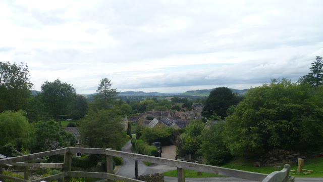
View from the Mount Inn

Broadway as you would expect on a sunny August Saturday was absolutely teeming with tourists. It is the place to bring your mum for afternoon tea, take note. We met  one of our fellow B & B guests, a splendid Italian chap brandishing his camera and indicating his surroundings with cries of ‘bella’ and ‘bellisimo.’ He evidently liked the place. We raided Budgens PS (posh supermarket) for a sandwich and grabbed a welcome coffee from the machine. Much as Broadway is a pull, we had to keep to our plan as the jungle and fierce wildlife in the triangle between Stanton, Snowshill and Stanway awaited us. You may laugh, but just days ago a driver on the Winchcombe – Cheltenham road spotted what looked like a panther on their journey. There is even an article about big cat sightings in Britain in the July issue of Lonely Planet.

This is the link for the recent sighting if you don't believe me: http://cryptoville.wordpress.com/2012/08/28/beasts-of-britain-new-sightings/

Snowshill The Cotswolds Stanway Winchcombe lavender Brigitte Jones Diary Cotswolds Way Broadway Chipping Campden Broadway Tower Cheltenham England countryside hills Stow on the Wold dells valleys Moreton in the Marsh Bourton on the Water stately home National Trust English eccentric long distance footpath
Stanton


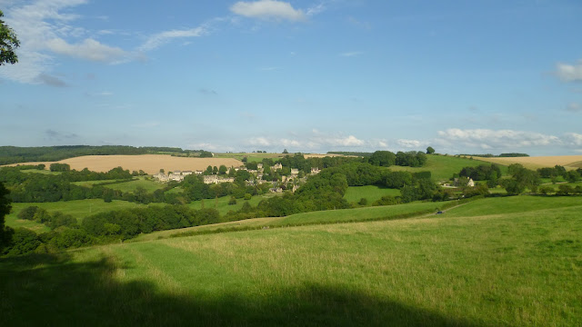
Returning to Stanton, we donned walking boots and headed up through the village, past the Mount Inn and up the Cotswolds scarp slope heading towards the hidden gem of Snowshill.  A little white terrier appeared in front of us and led the way up the footpath for some considerable time, occasionally looking behind him to check we were following. He obviously realised how important we were, but unbelievably disappeared into a sheep field later on, and we were left to find the route on our own. But we had a great map, and it would be easier to lose yourself in your own front room. After climbing the scarp slope, allowing a school of horse-riders to pass,  and negotiating some woodland, we found ourselves in a meadow looking down on Snowshill, a perfect English summer afternoon’s picture to feast on as we sat down for a break.

Snowshill The Cotswolds Stanway Winchcombe lavender Brigitte Jones Diary Cotswolds Way Broadway Chipping Campden Broadway Tower Cheltenham England countryside hills Stow on the Wold dells valleys Moreton in the Marsh Bourton on the Water stately home National Trust English eccentric long distance footpath
Our view of Snowshill


Snowshill The Cotswolds Stanway Winchcombe lavender Brigitte Jones Diary Cotswolds Way Broadway Chipping Campden Broadway Tower Cheltenham England countryside hills Stow on the Wold dells valleys Moreton in the Marsh Bourton on the Water stately home National Trust English eccentric long distance footpath
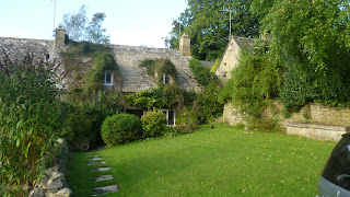
Snowshill cottage


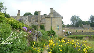
Reaching the village later we had a drink in the pub beer garden, although it was a little shame that vegetation hid the best of the valley’s views from us. Snowshill of course fulifils all the clichés, and Bridget Jones Diary used the village for filming, although there was no sign of men in bright jumpers with pictures of reindeer on them. After taking a few pictures around the village green, we set out towards Stanway back at the bottom of the scarp slope just south of Stanton. A foray across the fields and then through extensive woodland on the scarp brought us back down past Stanway House. Here there appeared to be a large social event going on in the gardens, looking suspiciously like a wedding. It called for white slacks, a striped blazer, a straw hat and an invitation, so we just peeped into the impressive grounds and continued on past the cricket pitch to the left and followed the Cotswolds Way along the scarp slope.


Snowshill The Cotswolds Stanway Winchcombe lavender Brigitte Jones Diary Cotswolds Way Broadway Chipping Campden Broadway Tower Cheltenham England countryside hills Stow on the Wold dells valleys Moreton in the Marsh Bourton on the Water stately home National Trust English eccentric long distance footpath
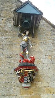
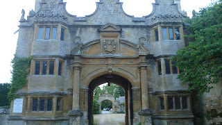
Entrance to Stanway House

Returning to  Stanton we really had to eat at the Mount Inn and indeed found outside seats with that view. Just made it before 9pm cut off this time and enjoyed sausages, mash and vegetables plus drinks, although the sloping table caused the gravy to overflow my plate and drip onto the ground!  A tray of tea (really pushing out the boat!) later rounded off an excellent day as we watched the night descend on a relatively warm evening.

The walk is an easy two to three hours depending on how quick you go, but of course you cannot fail to stop at some cosy pub or killer viewpoint to use up a bit more time.


Monday, 27 August 2012

Kit List for World Travel

This is my kit list for relatively low maintenance trips at home or abroad. I've used it for the last 20 years or so and it's pretty foolproof for a single guy travelling but obviously needs adjustment for families, couples, etc. It will also change according to type of trip, whether you are travelling at home, abroad, by car with extra space, etc. You'll need a bit more for jungle trips! And you won't be able to take it all unless you clone yourself!


Grooming:

Washbag 
Comb
Earplugs - useful for noisy city centre locations, youth hostels and snorers
Soap
Razor plus spares
Shaving gel
After shave gel
Flannel
Hairshampoo
Hair gel
Contact lenses plus spares and solutions
Toothbrush
Toothpaste
Towel
Deodorant
Toilet paper
Nail clippers
Small scissors
Tweezers
Vaseline
Elastoplast
Mouthwash
Blisteze - for chapped lips
Toothache tincture for dental pain
Nurofen tablets for toothache, etc
Mosquito milk//insect bite ointment
Jungle juice - essential in hot climates!
Suntan lotion
Cotton wool
Diorrehia tablets - you never know!
Paper tissues
Spectacles
Medicines
Mirror (for reflective surface freaks)

Clothing

Singlets
Jumper
Shirts
Underwear
Socks
Caghoul
Training shoes
2/3 shorts
I pair trousers/decent trousers
Hat
Jacket
Extra pair of shoes/decent shoes
Tracksuit
Pyjamas (can be considered redundant!)
Jellies - good for rocky shorelines like Croatia


Camping (basic list)

Tents plus pegs plus mallet
Sleeping bag
Sheet sleeping bag (tradition in Youth Hostels)
Pillow - only if travelling by car!
Lilo plus repair kit
plus pencil - useful for bunging air nozzles
Spare tent pegs
Camping information
Smaller lilo pump
Bungy

Sustenance - for campers and self caterers

Tea bags
Sugar
Mug
Tin opener
Knife
Saucepans
Spoon
Plate
Flask
Waterbottle

Money

Wallet
Travellers cheques - I don't use anymore (does anyone?) despite their distinguished appearance
Cheque book - optional these days
Foreign currency
Debit/credit cards - I recommend a Fairfx currency card for pre-loaded currency, they give excellent rates
(Natwest) card reader

Documentation

Passport
Diary
YHA card - if you are planning on some hostelling
Notebook plus texts
Language dictionaries
Bible
Insurance policy
International driving licence - check if country of destination needs one
Ordinary driving licence
Interrail pass
Maps
Lets Go
E111 card
International timetable if train travelling

Miscellaneous

Money bag
Alarm clock - redundant if mobile phone alarm
Pens
Small rucksack/day bag
Calculator - redundant if mobile
Torch plus batteries
Sunglasses
Camera
Charger for camera
String
Matches
Goggles - for swimming
Snorkelling gear
Tape
Scissors
Beachmat plus picnic chairs - if travelling by car!
Tennis racket plus balls
Plastic bags
Lilo pump
Spare bag
Frisbee - showing my age!
Football
Mobile phone
Mobile charger
Adaptor for plugs abroad
Laptop/notebook computer
Headphones
Memory stick
Charger for laptop
Camera – laptop lead
Walking boots plus socks
Wet gear

Cold climate

Handcream
Gloves
Scarf
Winter hat

Bicycles

Oil
1 inner tube
Tyre levers
Lights
Pump
Puncture outfit
Screwdriver
Spanner
Spare spokes
Cycle clips
Panniers


Thursday, 16 August 2012


South Downs Way


Washington car park – Amberley - Littleton Farm

To take a walk from the car park west, you have to find it first! It nestles just off the A24 Worthing - London road and can be reached from Worthing by driving north on the A24 until you reach the Washington roundabout; take the exit at 4 o’clock, pass the garage on your right and then turn right almost immediately into Washington village. Drive straight past the pub on your right and then follow the road up through a wooded area until you get to a sharp bend left off the tarmac onto a gravelly track that takes you into the car park.

If you’re heading west on the SDW, retrace your route from the car park and cross the A24, then pick up Glaseby Lane that winds up from the main road. Soon it bends round to the left, past one or two houses, whilst on the left is the Washington Tap, yes, another water stop, marked by a sign saying 7 miles to Botolphs, 6 miles to Amberley.

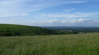
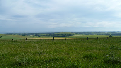
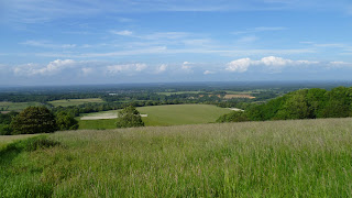
Going on, to the left of the entrance to Bostal Hill Farm the lane is sealed off to further motor vehicle progress by a lockable metal pole in the middle of the thoroughfare and a corresponding sign; beyond, the lane continues steep and sheltered almost completely from the sun, taking you up to a gate and crossroads. Carry straight on over what appears to be some sort of cattle trap by the gate. The path continues upwards onto open downland with views of the Sussex weald to the north and sheep grazing to the south. It’s a glorious day and you can see the North Downs in the far distance; betwixt here and there is gently undulating scenery splashed with plentiful woodland.


As you near the top of the hill just to your right is a concrete bunker which must have been some sort of world war 2 gun emplacement / lookout point, complete with hole in the top and slits to peruse the surrounding country. Much of it is covered in rusting squares of metal.
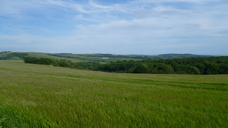
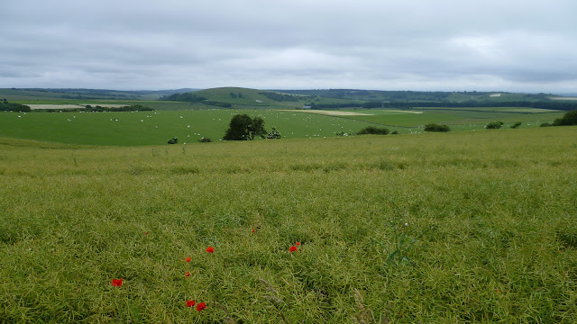
Shortly, the seascapes have opened up and you can see the English Channel beyond Worthing and Cissbury ring. Fields of yet to flower poppies are on both sides. Down to the left is a large wooded area but before that another concrete bunker snug in the fields.
At this point a route strikes off the path north (alternative SDW route avoiding the A24).


South Downs National Park South Downs Chanctonbury Ring Cissbury Ring Bignor Hill Truleigh Hill Devil’s Dyke Brighton Worthing Steyning Washington Storrington Ashington Hills downs sheep countryside England English South East England Arundel Amberley pond sheep dip dew pond South Downs Way drovers’ tracks vegetation woodland woods Arun river valley Adur river valley scarp slope downland Wiston Park A24 Shoreham by Sea Sompting Chiltington Fulking Poynings A23 Brighton Slindon Chichester Parham House Winchester Midhurst Pulborough Petworth rolling gentle cattle Arundel Castle Bury
Looking towards Worthing and the sea


South Downs National Park South Downs Chanctonbury Ring Cissbury Ring Bignor Hill Truleigh Hill Devil’s Dyke Brighton Worthing Steyning Washington Storrington Ashington Hills downs sheep countryside England English South East England Arundel Amberley pond sheep dip dew pond South Downs Way drovers’ tracks vegetation woodland woods Arun river valley Adur river valley scarp slope downland Wiston Park A24 Shoreham by Sea Sompting Chiltington Fulking Poynings A23 Brighton Slindon Chichester Parham House Winchester Midhurst Pulborough Petworth rolling gentle cattle Arundel Castle Bury
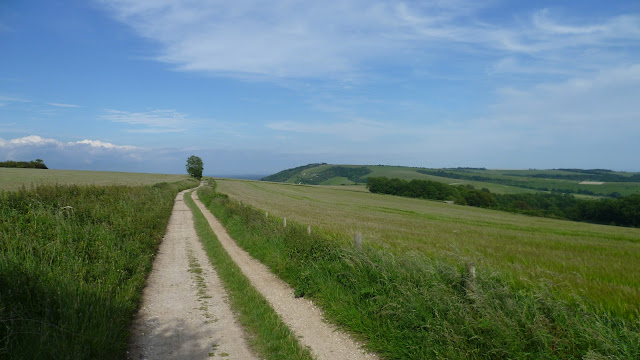
East to Chanctonbury Hill along South Downs Way


South Downs National Park South Downs Chanctonbury Ring Cissbury Ring Bignor Hill Truleigh Hill Devil’s Dyke Brighton Worthing Steyning Washington Storrington Ashington Hills downs sheep countryside England English South East England Arundel Amberley pond sheep dip dew pond South Downs Way drovers’ tracks vegetation woodland woods Arun river valley Adur river valley scarp slope downland Wiston Park A24 Shoreham by Sea Sompting Chiltington Fulking Poynings A23 Brighton Slindon Chichester Parham House Winchester Midhurst Pulborough Petworth rolling gentle cattle Arundel Castle Bury
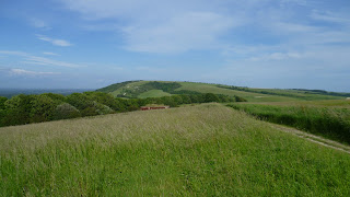
Chanctonbury in distance

You are now riding the crest of the South Downs and can see Storrington to the north and the definition of the Isle of Wight clearly to the west. Open downland dominates the landscape just as it does east from here to Eastbourne.
At this point we have Sullington Hill to the right and a path weaves its way down off the main track to Sullington and Storrington. Your landmark is a large corrugated iron shed. Walking is easy as we’re on the level.


South Downs National Park South Downs Chanctonbury Ring Cissbury Ring Bignor Hill Truleigh Hill Devil’s Dyke Brighton Worthing Steyning Washington Storrington Ashington Hills downs sheep countryside England English South East England Arundel Amberley pond sheep dip dew pond South Downs Way drovers’ tracks vegetation woodland woods Arun river valley Adur river valley scarp slope downland Wiston Park A24 Shoreham by Sea Sompting Chiltington Fulking Poynings A23 Brighton Slindon Chichester Parham House Winchester Midhurst Pulborough Petworth rolling gentle cattle Arundel Castle Bury
North to Storrington


South Downs National Park South Downs Chanctonbury Ring Cissbury Ring Bignor Hill Truleigh Hill Devil’s Dyke Brighton Worthing Steyning Washington Storrington Ashington Hills downs sheep countryside England English South East England Arundel Amberley pond sheep dip dew pond South Downs Way drovers’ tracks vegetation woodland woods Arun river valley Adur river valley scarp slope downland Wiston Park A24 Shoreham by Sea Sompting Chiltington Fulking Poynings A23 Brighton Slindon Chichester Parham House Winchester Midhurst Pulborough Petworth rolling gentle cattle Arundel Castle Bury
South to the sea
South Downs National Park South Downs Chanctonbury Ring Cissbury Ring Bignor Hill Truleigh Hill Devil’s Dyke Brighton Worthing Steyning Washington Storrington Ashington Hills downs sheep countryside England English South East England Arundel Amberley pond sheep dip dew pond South Downs Way drovers’ tracks vegetation woodland woods Arun river valley Adur river valley scarp slope downland Wiston Park A24 Shoreham by Sea Sompting Chiltington Fulking Poynings A23 Brighton Slindon Chichester Parham House Winchester Midhurst Pulborough Petworth rolling gentle cattle Arundel Castle Bury
Weald of Sussex


You now lose sight of Storrington and are faced with a wonderful sweep of countryside between the South Downs Way and the sea of which you have an uninterrupted view virtually from Cissbury to the Isle of Wight. The area immediately to the left is the Angmering Park Estate and forms the mellowest of English landscapes. It really is a belter of a walk along this stretch, with landscapes and seascapes a real eyeful for the rambler. Along the way you hit the Chantry car park, at the top of Chantry Hill,  where the signpost marks a major crossroads: east to Washington, west to Amberley, north to Storrington, south east to Long Furlong and south to Lee Farm. A narrow access road falls north from this point to meet the A283 at Storrington. For the agriculturally minded, grain dominates the landscape.


South Downs National Park South Downs Chanctonbury Ring Cissbury Ring Bignor Hill Truleigh Hill Devil’s Dyke Brighton Worthing Steyning Washington Storrington Ashington Hills downs sheep countryside England English South East England Arundel Amberley pond sheep dip dew pond South Downs Way drovers’ tracks vegetation woodland woods Arun river valley Adur river valley scarp slope downland Wiston Park A24 Shoreham by Sea Sompting Chiltington Fulking Poynings A23 Brighton Slindon Chichester Parham House Winchester Midhurst Pulborough Petworth rolling gentle cattle Arundel Castle Bury
South to the sea


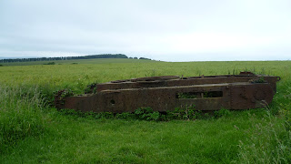
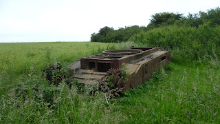
Further on, within sight of Kithurst Hill car park, you reach a sign-posted route down to Storrington to the right (1 and a half miles) and a public bridleway to the left. Strike south on this track and soon you stumble upon the rusting remains of an old battle tank, now a permanent relic.


South Downs National Park South Downs Chanctonbury Ring Cissbury Ring Bignor Hill Truleigh Hill Devil’s Dyke Brighton Worthing Steyning Washington Storrington Ashington Hills downs sheep countryside England English South East England Arundel Amberley pond sheep dip dew pond South Downs Way drovers’ tracks vegetation woodland woods Arun river valley Adur river valley scarp slope downland Wiston Park A24 Shoreham by Sea Sompting Chiltington Fulking Poynings A23 Brighton Slindon Chichester Parham House Winchester Midhurst Pulborough Petworth rolling gentle cattle Arundel Castle Bury
Old battle tank


South Downs National Park South Downs Chanctonbury Ring Cissbury Ring Bignor Hill Truleigh Hill Devil’s Dyke Brighton Worthing Steyning Washington Storrington Ashington Hills downs sheep countryside England English South East England Arundel Amberley pond sheep dip dew pond South Downs Way drovers’ tracks vegetation woodland woods Arun river valley Adur river valley scarp slope downland Wiston Park A24 Shoreham by Sea Sompting Chiltington Fulking Poynings A23 Brighton Slindon Chichester Parham House Winchester Midhurst Pulborough Petworth rolling gentle cattle Arundel Castle Bury


Back on the SDW, a gentle descent takes you to the car park, again accessible from the B2139 west of Storrington – there is space a plenty for cars and it’s an ideal spot for an evening barbecue. On a hot August day there still the bewitching sight of the Isle of Wight hazy on the far horizon.

West from Kithurst Hill the path climbs Springhead Hill, rolling open downland continues to the north and south, with extensive, unencumbered  views of the sea and weald. You then hit a strip of woodland with a spur that rudely interrupts the landscape by striking south in a dead straight line of trees, obscuring the panorama.

Once through the trees, however, you get your first glimpse of Arundel Castle away to the south west, the Arun river snaking in front of it. To the north and way below is Parham House, a beautiful Elizabethan mansion in accompanying parkland that kisses the foot of the Downs. At this point pheasants, possibly the daftest animals on God’s earth, are chasing along the other side of the fence, and we begin to descend into the Arun valley.

The view opens right out again in three - dimensional splendour and you can see across to Bignor Hill and Arundel Park on the far side of the river.

Soon the path drops steeply with a magnificent vista of the Arun valley; reaching the level again, with the ample outbuildings of Downs Farm to the left. The path falls further, winds into some trees, then hits the road up to Downs Farm from Amberley. You then follow the road down past an interesting looking Victorian House on the right, set in a nook with an incomparable setting. It was at this point that in the evening, whilst retracing my steps, a multi-coloured balloon passed overhead and appeared to come into land just north of the South Downs. I watched as it failed to land and skated north across the countryside, eventually disappearing into the distance as I focused on other things.

You carry straight down to the main Amberley road; on the way is an interesting little sunken enclosure adjacent to the lane and on the left – a square of grass, a small shelter and a bench on a mound looking out over Amberley Museum, nestled in the old quarry.

Reaching the bottom, you find the lane is called High Titten, and a signpost surprises you with the fact that you are 50 miles from Eastbourne and 51 miles from Winchester (HALF-WAY MARK!)

If you want to keep to the SDW you turn north along the main road for a few hundred yards, but this is a good spot for diversionary tactics. Turn left and follow the wind of the main road and you find yourself in the bit of Amberley by the river. In this cosy hamlet you can have a drink at the Bridge Inn  - half a Guinness at £1.40, lunch at the Boathouse Brasserie, or visit the Riverside tea garden & restaurant (jacket potato with bacon, cheese and salad + pot of tea for £6.40). If you’ve finished your walking you can catch the train home from Amberley Station.

Returning to the SDW, a secluded pedestrian path clutching the main road brings you to a bridle-way that strikes west across the valley. Almost immediately you cross a railway bridge from which you can see the medieval pile of the Amberley Castle Hotel to the north.

Carry straight on and soon the well sign-posted path bears left for a while, then right and converges with the River Arun. Cross the cream coloured bridge and if you’re not tempted to return to the nearby riverside tea rooms again, you trace the Arun for a short distance until it veers north – west, perhaps gaining sight of a tent on the bank or a canoe on the water.

You’ve now traversed the floodplain with its cow covered meadows, river and ditches and the path begins to climb again onto the downs. As you make your way up to the A29 grain continues to dominate the landscape and if it’s late August/ early September the combine harvesters will be working across the curves.

Another terrific view of the Arun valley behind you opens up as you begin to hug the side of Coombe Wood. Over the A29 and keep climbing, you reach another summit where the perspective multiplies, turn round to see the Arun valley and look over Houghton Forest to the south-west and the sea.

2) The path continues to climb steadily, with Houghton Forest on your left and the immediate surroundings of open down-land. In the distance to the left are the TV/radio masts just beyond Bignor Hill. You are now on Westburton Hill, grain again being the main crop.
The track then rolls along at a gentle pace on the level, diverging slowly from the woods on the left, and meanwhile the view to the north opens up again with its distant line of hills. Later the track begins to descend towards an outbuilding on the floor of the vale; this proves to be a large storage shed partly filled with hay bales.
A little further on, a major intersection indicates the SDW to the left; the path immediately climbs up fairly steeply through some tree cover, and eventually a T-junction indicates right. We are now back on open down-land with a great view of the Weald to the north-east opening up. Very quickly the path veers to the left and heads west. Climbing steadily upwards, and after passing a sign ‘Slindon Estate,’ you are awarded an almost 360 degree view – to the east along the scarp slope of the downs, Houghton Forest and the drink to the south, and a panoramic view of the weald as we find ourselves on Bignor Hill (225).
The path caresses the top of the downs, then dips to the left of woodland towards the car park, running almost parallel to the tree line 200 yards to the right.
Bignor is a major thoroughfare for downs activity. There is ample car-parking with a lane dropping north-east to Bignor village. A bumper size sign-post indicates paths to Sutton to the north, Slindon to the south, Noviomagus and Londinium (the same direction as Bignor). At this point you are 208m above sea level.
On a gate-post near the signpost the SDW is indicated, heading off towards the radio mast, then forking to the left to Gumber Bothy. Shortly you hit another signpost and a track off to the left goes to Gumber itself (1 ¾m) where you can stay the night in the camping barn or erect your tent perhaps with the farmers’ permission.
A little further on the landscape opens out again with views across forest and wood to the sea beyond the coastal plain. The SDW follows a fence across a large field chasing the contour, with sheep grazing to the left and radio mast to the right.
At the other end of the field a signpost points to Gumber Bothy 1800m to the south. Carry straight on at this crossroads which marks the end of the Slindon Estate.
Moving ahead, the track then moves gently across the landscape, crosses through a line of trees, then reveals another classic English landscape as we begin to descend into the valley through which the A285 runs. Your landmark here is Littleton Farm, sitting right on the road.

Wednesday, 15 August 2012


The Cotswolds

Stanton


‘Poshtershire,’ (at least the Gloucestershire part) as it has been christened, land of 'posh peasants' and celebrities like Liz Hurley, the Blur cheese maker and Dom Joley. Green wellies, 4X4s and horsewomen oozing out of the landscape, the chipping Norton set, David Cameron’s home constituency. Prince Charles, Highgrove, Badminton horse trials and handcrafted biscuits, it’s all there. No region of the UK would be more clichéd than this wedge of countryside bounded by three of England’s big motorways, the M4 to the south, the M5 to the west and the M40 to the east. If you’re travelling down any of those routes and get a bit bored, take a diversion off the beaten track and hit some of the country lanes that will take you into the heart of an area that the Japanese choose to visit only second to London when they come to the UK (they like visiting Beatrix Potter land as well in the Lake District!). If you want to see lots of people driving open top sports cars, racehorse territory, classic English villages, rolling countryside, cosy country pubs and architecture that seems to have almost grown out of the ground to suit its surroundings, then go to the Cotswolds.  If you come from abroad, England is like a giant garden, with a landscape that has been tended for centuries, and there is no better area to get a taste of the UK experience than deepest Gloucestershire and Oxfordshire. For Lord of the Rings fans, there are also some interesting Tolkien links with the Cotswolds. When you observe the cottages almost growing out of the hills and valleys you just have visions of ruddy faced peasants with waistcoats and breeches smoking impossibly long pipes and wearing green hats with bells on the end. If a staff wielding Gandalph descended from the sky you wouldn’t be surprised

The Cotswolds was built on the wealth of the wool industry of the Middle Ages which has left a priceless heritage in its architecture of glorious 'honey' coloured stone. Every village and town has its church, town houses and cottages with the same weathered fawn tan almost without exception, including new builds. Farms, stately homes and great houses cover the countryside likewise. Driving through the endless winding country lanes up and down over hill and dale there’s always another delight around every corner, a pristine little village, a gated stately home, or a rambling farmstead. It is as if the perfect symmetry of colour between settlement and landscape originated in the heart of God himself to create a marvellous palette for our enjoyment.

Cotswolds landscape is principally gentle hills and rolling countryside still with spashes of woodland, but at the extreme western edge of the area, to the east of the M5 is the Cotswolds escarpment which stretches down north-east south-west towards the Bristol Channel . This is as rugged as the Cotswolds gets if you can use such a word, where the scarp slope yields fabulous views westwards  at windswept spots such as Cleeve Hill near Cheltenham and Broadway Hill near Chipping Campden. If you’re into walking, the Cotswolds Way traces this escarpment and runs 102 miles from Chipping Campden in the north to Bath in the south . Now there’s a name that might resonate, once you’ve done the Cotswolds, you can sink a glass of wine in the Regency  fleshpot which continues the Cotswolds theme with its distinctive architecture.

I choose B & B when I visit the Cotswolds as it can be excellent value and homely and you are guaranteed the famous British breakfast to start the day. I’ve ended up at Brymbo near Chipping Campden which is great and provides a good base for the northern Cotswolds and the Cotswolds Way. Also they give you a free tour of the Cotswolds if you stay three nights and the proprietor will take you on a 4x4 circular into lesser known extremities which normal cars can’t handle like the odd ford and cross country track. I also stayed at a farmhouse, New Farm just north of Moreton in the Marsh and stumbled upon an alcoholic beverages festival, as you do. There are any number of towns or villages to base yourself, all of them beautiful, Stow on the Wold, Moreton in Marsh, Chipping Campden, Bourton on the Water, Broadway, Winchcombe are ones I am more familiar with. Take your pick, you won't be disappointed.


Highlights

Snowshill  http://www.cotswolds.info/places/snowshill.shtml– if Bilbo Baggins lived in the Cotwolds he would live here in this impossibly ‘English’ English village. The village has been sculpted out of the sides of the Cotswolds escarpment and has great views out west. The tiny triangle of green with church is surrounded by clutches of cottages which hang off the main road on the west side. Beware if you have a car because there’s not much space to park here, it’s such a tiny village centre. Down the road is Snowshill Manor, a Tudor mansion, for a culture visit. If you’re walking the Cotswolds Way Snowshill would be a great diversion barely a mile to the east off the main track. The main road leading into the village is bounded by lavender fields which grow over 35 different varieties. http://www.cotswoldlavender.co.uk/

Stanton
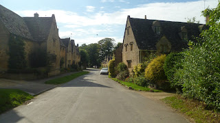
Stanton – could easily pose as anyone’s favourite Cotswolds village, it sits on the scarp slope bang on the Cotswolds Way and is a photographer’s heaven. I did not see any shops but there is a pub at the top of the village right up on the slopes with an open air dining area, not a bad spot to eat and peruse the view!
Stanton

http://www.cotswolds.info/places/stanton.shtml

Stanway – another village that sits at the bottom of the Cotswolds escarpment but this time in the bosom of a Jacobean stately home complete with its own spectacular fountain. If you’re there on the right day you might get a view of it working. Again the village sits on the Cotswolds Way and is ideal for a lunch break, although not a place for shops. http://www.the-cotswolds.org/top/english/know/villages/stanway/index.html

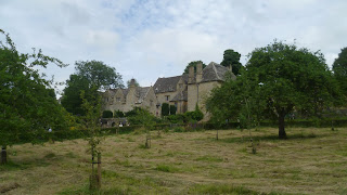
Stanway House


Chipping Campden – this is the main Cotswolds town at the north end of the region and would make for a great base. It would definitely be a contender for most seriously gorgeous and attractive Cotswolds town, although it would have plenty of competitors! By the way the Lygon Arms Hotel does a great steak and kidney pie and chips! The town is centred on a long spacious central drag bounded by uniformly honey coloured and perfectly tailored buildings. The Woolstaplers Hall, for hundreds of years the Wool Exchange,  sits above the street in the centre. The beautiful church lies up a side road and gives onto another very idiosyncratic street of cottages. If you are into walking, the Cotswolds Way starts on the edge of town and heads up onto the top of the scarp slope at Dover’s Hill. this makes for a good afternoon walk.

http://www.chippingcampden.co.uk/

Main street Chipping Campden


Quaint street in Chipping Campden
Main street Chipping Campden


Chipping Campden


Church in Chipping Campden


Chipping Campden


Broadway – sits like a majestic maiden aunt at the bottom of the Cotswolds scarp slope, virtually on the edge of the region but with everything you could want for the Cotswolds experience, a wide central thoroughfare that opens out at the bottom with tea shops, restaurants and a Budgens supermarket (they seem to pop up in posh middle class areas), and a long straight road climbing the hill bordered by old houses that look like they’ve been built for a Downton Abbey spin off. A feast for the eyes as you envy living in such a spot.http://www.broadway-cotswolds.co.uk/ . Broadway was described on a  recent TV programe as pretty well too perfect, but visit yourself and decide.

At the top of the hill above Broadway sits Broadway Tower, a folly with connections to William Morris and the Arts and Crafts movement of the nineteenth century. For a small fee you can climb up the levels in the tower to the top and enjoy the exhibitons. There is a shop at the bottom. It commands great views out towards Wales and is near a very welcome cafe atop the scarp slope with its own car park and viewing area. The cafe has plenty of outside seating with great views to enjoy as you have your lunch. It sits on the Cotswolds Way. There is also a nuclear bunker there which can be visited.http://www.aquiziam.com/broadway-tower-nuclear-bunker.html

Broadway Tower

Moreton in Marsh – on the main A429 Roman road (the Fosse Way) and the main line from London Paddington.  A good base for touring the Cotswolds. The market town straggles along the long straight wide main street in typical Cotswold fashion. There’s a good fish and chip shop on the right as you enter the town from the north. A bit further down turn right and take the A44 road towards Broadway. A little way down this road on the left is the Wellington Aviation Museum which provides an exhibition giving tribute to Second World War bomber command that was based near here in the war. I stayed at a B& B over the railway bridge to the north and left turn off the main road.

Bourton on the Water – this is a mini Venice in the Cotswolds with a stream running right through the centre of town with grassy spaces and a perfect backdrop of local architecture. The stream, paths, grass and road make for a nice wide thoroughfare in the centre and a large car park a few minutes outside the centre within easy walking distance helps keeps things pedestrian friendly.
Bourton in the Water centre
If you wanted to visit just one town in the area if short of time this would be a great choice and you can easily hop over to the ridiculously pretty villages of Upper and Lower Slaughter, or drive or bike out to the Rissingtons, a clutch of worthy villages for photography expeditions.

Naunton – a little gem of a village off the main B4068 west of Bourton on the Water

The Slaughters – you can easily do these in one afternoon by walking from Bourton on the Water, a short amble through the countryside. Upper and Lower Slaughter are a stone’s throw apart and are both a jumble of manicured cottages, posh looking hotels and the odd stately home thrown in for good measure. Definitely ‘go back in time’ territory, and take the words quaint, picturesque, gorgeous and typically English to a new level.
Lower Slaughter is the first village you reach from Bourton. It's the sort of place that celebrities would pick to have their wedding reception in the local hotel and then get the pictures into Hello magazine. The main street that winds down into the vilage shares space with a delightful stream that winds between peaceful Cotswolds cottages.

Lower Slaughter
http://www.cotswolds.info/places/lower-slaughter.shtml

Head up the road and you soon get to Upper Slaughter which seems slightly more remote but no less gorgeous. It centres on a large mansion which seems to sit plonk in the middle of the village like an aged matriarch surrounded by a gaggle of cottages. Take a side road near the church that takes you down to a clutch of settlement hanging on to the coattails of the main village.

A good idea if you have the time is just to take a turn of a main road in the Cotswolds and follow the little country lanes that swarm over this mature piece of English landscape as the mood takes you, and just enjoy what you come across around every bend or or every hill.


Lower Slaughter stream


Lower Slaughter

http://www.cotswolds.info/places/upper-slaughter.shtml


Stow on the Wold – with a name like somewhere Toad of Toad Hall should live (perhaps he does!), this market town on a hill is a good central transport hub with roads to Broadway, Moreton in Marsh, Chipping Norton, Bourton on the Water, Cheltenham and Burford. It has a very attractive central Market square, and is a great place for a wander to admire the architecture and general ambience. Get some grub as well. I went as far as getting soup for lunch on the main square but if you don't meet Toad of Toad Hall you migh find 'toad in the hole' for lunch as the next best thing! http://www.cotswolds.info/places/stow-on-the-wold.shtml

Winchcombe – this little town sits on the western edge of the Cotswolds on the road to Cheltenham but is well worth a visit as a base to see Hailes Abbey, Sudeley Castle, and access the Cotswolds Way and Belas Knap. It sits comfortably in a beautiful Cotswolds valley between Cheltenham and Broadway. It has a long sinuous main street that is bordered by classic Cotswolds buildings, and dropping off the main street to the east is a little street that crosses a river and leads up to the entrance to Sudeley Castle.
http://www.cotswolds.info/places/winchcombe.shtml


Winchcombe Station - press the button!


Belas Knap - this is an ancient site that sits on top of the hills above Winchcombe on the Cotswolds Way. It comprises a mound surrounded by a stone wall and with little gateways or doors on the side. There is woodland here that is suppose to have given inspiration to Tolkien for his writings, but I didn't bump into any hobbits myself up there!

http://www.english-heritage.org.uk/daysout/properties/belas-knap-long-barrow/


Belas Knap


Hailes Abbey

Henry Viiith put the boot in here with the dissolution of the monasteries but the remains give you an idea of just how magnificent the original abbey must have been. a well worth it tour with audio guides to make your visit much more user friendly. The Cotswolds Way passes by this piece of heritage.

http://www.nationaltrust.org.uk/hailesabbey/


Painswick – another picture perfect Cotswolds town that nestles in a valley on the main A46 north of Stroud.  It has been referred to as the ‘Queen of the Cotswolds.’ It’s quite an up and down centre with little ascents and winding streets to add to its charm, its settlement tumbling down the valley to the south east from the centre. It is on the Cotswolds Way and has great walks around the hilly vicinity; within minutes you are in peaceful rolling meadows, dappled woodland or high above the town on grassy slopes. http://www.cotswolds.info/places/painswick.shtml. If you want to experience a classic English town srrounded by typical lush English coutryside you could do a lot worse than this.


Centre of Painswick

Painswick - main street


Painswick countryside

Tractor in field - Painswick
Painswick church


Burford

Can be seen as the southern gateway to the Cotswolds. If you are an international visitor coming straight from Heathrow or Gatwick this might be the first genuine Cotswolds town you come across and it's a belter to boot. It was voted 6th best place to live in Europe in 2010 by Forbes magazine so that's got to be a recommendation. Coming into town you are quite high up, then descend down a marvellous main throughfare bordered by classic old Cotswolds architecture to the River Windrush. There are lots of little lanes, pubs, cafes and shop to explore. You could do a lot worse than start your Cotswolds experience here.

http://www.cotswolds.info/places/burford.shtml


Blenheim Palace, Woodstock

The is one of the biggest stately homes in the UK, a huge pile that dominates a large area of parkland on the edge of the attractive Cotswolds town of Woodstock. It's just about the nearest thing I've seen to Versailles in the UK, a great central core with two massive wings fanning out to either side. Take the road north out of Oxford for a few miles and Blenheim lies to the left of the main road as you enter Woodstock. Take the entrance gate, drive through the parkland, park up and enjoy a tour of the Palace and a walk in the extensive grounds which have a substantial lake and an obelisk. Blenheim is famous for its Churchill connections. Winston Churchill was born here and you can do the Churchill tour of the palace. There is a substantial restaurant where you can enjoy some traditional food like sausages and mash.

http://www.blenheimpalace.com/


Just down the road from Blenheim Palace is the village of Bladon where Winston Churchill was buried in 1965 in the village churchyard.


The Cotswolds Way – I have walked the stretch from Chipping Campden nearly to Stroud as it traces the Cotswolds escarpment through gorgeous countryside with fine views out over the Severn Valley and to Wales. It is 102 miles in length. Ideal for walking but be careful if you want to bike it as it is not set up for cycling along the whole route, there are only fragmented sections for two wheels. I did read of fines being imposed for illegal biking so be careful, it is a trail really set up for walkers. I met three Aussies on the trail last year who were scheduled to do a walk in Japan but had cancelled because of the earthquake and came to the Cotswolds instead.